Community Outreach
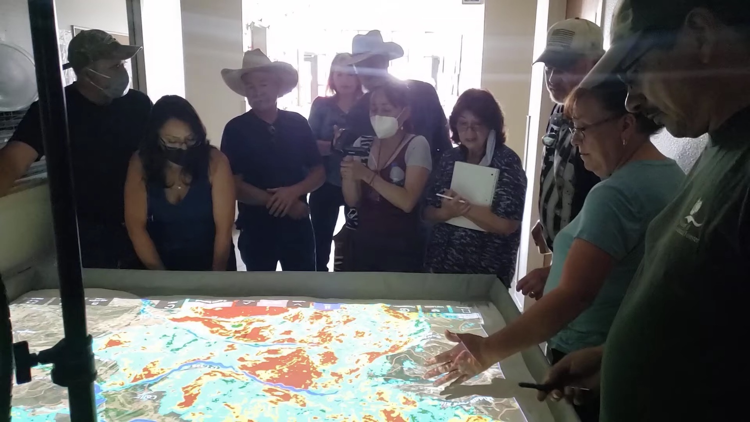
Thousands of communities face high potential for fire danger and educating public and private stakeholders has been a challenging endeavor until now. Simtable allows citizens to easily operate and collaborate in the planning, training and outreach needed to help design effective emergency management plans for their communities.
Using Simtable, a 3-D map of neighborhoods is projected with up-to-date satellite imagery of structures and streets, color coded with Firewise ratings, giving citizens and first responders a bird’s eye view and ground level simulation of their community.
“I’ve never seen a group so engaged at a Firewise presentation”
– Dave Sperling, Deputy Fire Chief, Santa Fe County
Simtable educates the public about fire behavior and all-hazards management in their own neighborhoods and simulates mitigation plans and scenarios. Simtable is the most powerful and dynamic way to bring GIS data and interactive presentations to life.
Simtable facilitates community outreach with education and planning in:
- Firewise Education
- Fuels Management
- Evacuation Planning
- Population Modeling for Vehicles
- Dynamic Evacuation Routes and Points
Videos from our partners in New South Wales, Australia employing Simtable in their community outreach efforts: